Note:
The item location is abroad. Please note that this may affect delivery conditions, shipping times, and/or the purchasing process.
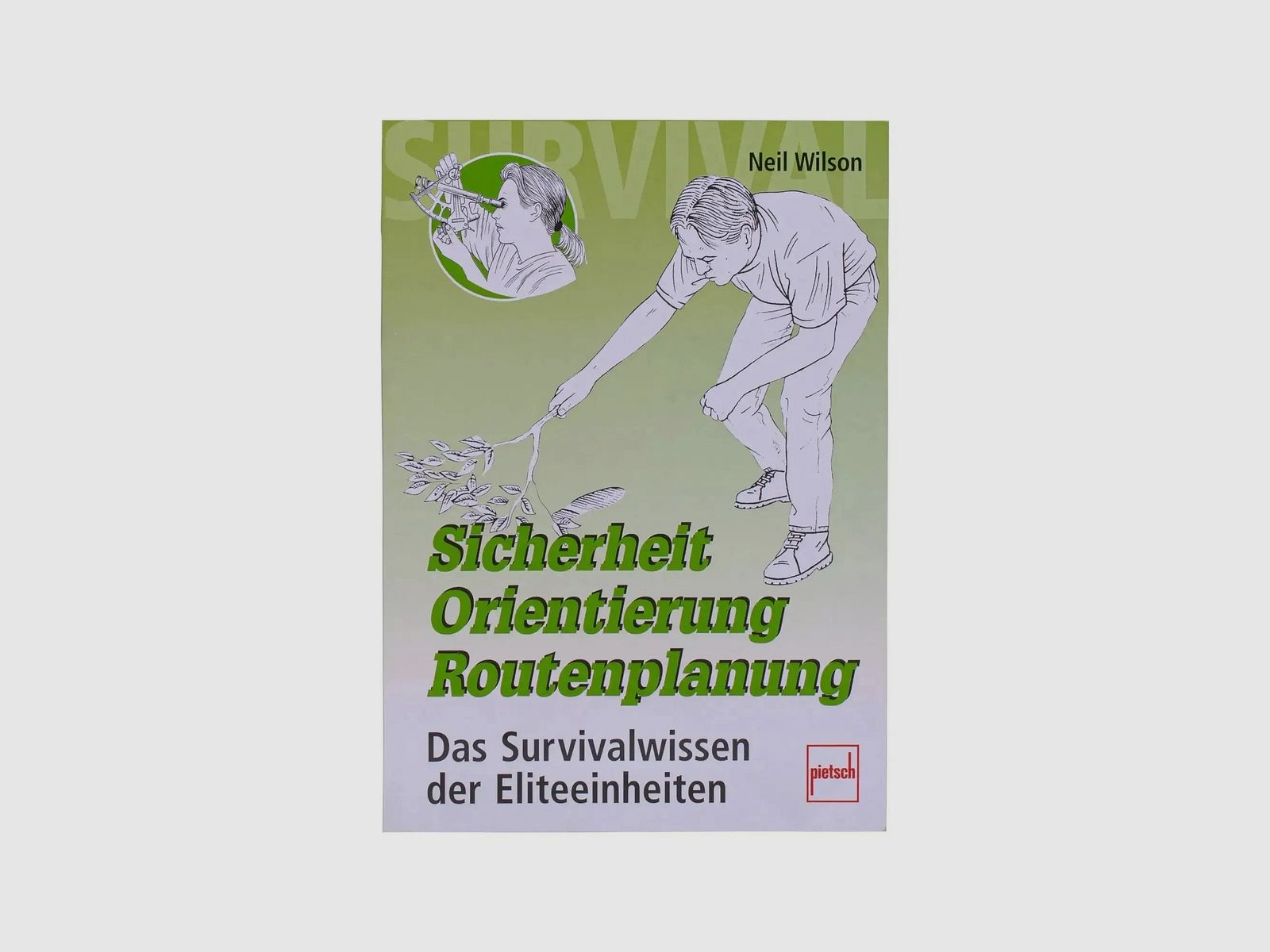
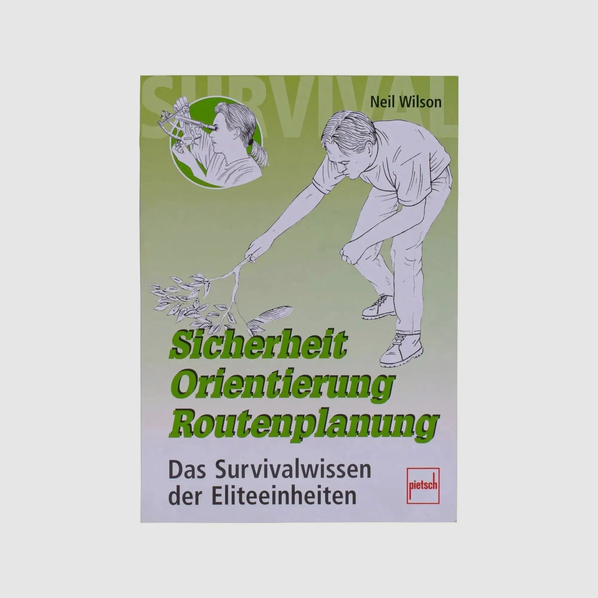
Neil Wilson: "Safety, Orientation, Route Planning" helps to find the right path in difficult terrain. It shows how maps are structured, how to read them, and how to transfer their information onto the terrain. It explains the use of compass, elevation meter, pedometer, sextant, and GPS device, describes how to determine direction and distance using maps and protractors as well as with the compass. But even without technology, one can navigate with this book: How can you tell where south is by looking at a tree? What does the position of the sun or a glance at the night sky tell you? How can you build a compass with the simplest means? Furthermore, the author describes orientation in the terrain based on a given marching number and how to determine a point on the map through triangulation. He shows how to circumvent obstacles and monitor the marching direction in unclear terrain. The chapters "Tracking," "Camouflage," "Escape from a Threatening Situation," as well as Rescue and Recovery contain important tips for ensuring personal safety in unsecured terrain. - 176 pages - 100 color illustrations - Author: Neil Wilson - Title: Safety, Orientation, Route Planning - The Survival Knowledge of Elite Units - Dimensions: 240 x 170 mm
(Show description in original language)
Neil Wilson: »Sicherheit, Orientierung, Routenplanung« hilft, den rechten Weg in schwierigem Gelände zu finden. Es zeigt, wie Karten aufgebaut sind, wie man sie liest und ihre Informationen auf das Gelände überträgt. Es erklärt den Gebrauch von Kompass, Höhenmeter, Schrittzähler, Sextant und GPS-Gerät, beschreibt die Bestimmung von Richtung und Entfernung nach Karte und Kartenwinkelmesser sowie mit dem Kompass. Doch auch ohne Technik findet man sich mit diesem Buch zurecht: Wie erkennt man an einem Baum wo Süden ist? Was sagt einem der Stand der Sonne oder der Blick in den Nachthimmel? Wie kann man sich mit einfachsten Mitteln einen Kompass bauen? Darüber hinaus beschreibt der Autor die Orientierung im Gelände nach vorgegebener Marschzahl und das Bestimmen eines Punktes auf der Karte durch Kreuzpeilung. Er zeigt, wie man Hindernisse kontrolliert umgeht und die Marschrichtung in unübersichtlichem Gelände überwacht. Die Kapitel »Spurenlesen«, »Tarnung«, »Flucht aus bedrohlicher Situation« sowie Rettung und Bergung enthalten wichtige Tipps zur Gewährleistung der persönlichen Sicherheit in ungesichertem Gelände. - 176 Seiten - 100 Farbabbildungen - Autor: Neil Wilson - Titel: Sicherheit, Orientierung, Routenplanung - Das Survivalwissen der Eliteeinheiten - Maße: 240 x 170 mm